The Wind
The sun’s energy heats Earth according to the varying incidence of its rays, more at the equator and less at the poles. Temperature differences result in areas of different pressure.
The wind originates from a mass of air that searches for balance, from a high-pressure area to a low-pressure area pushed by the force of the Pressure Gradient.
A Gradient or G ratio; describes the relationship between two points at equal heights and their distance.
G = ∆p / ∆s, where ∆p is the pressure variation between two points and ∆s their distance.
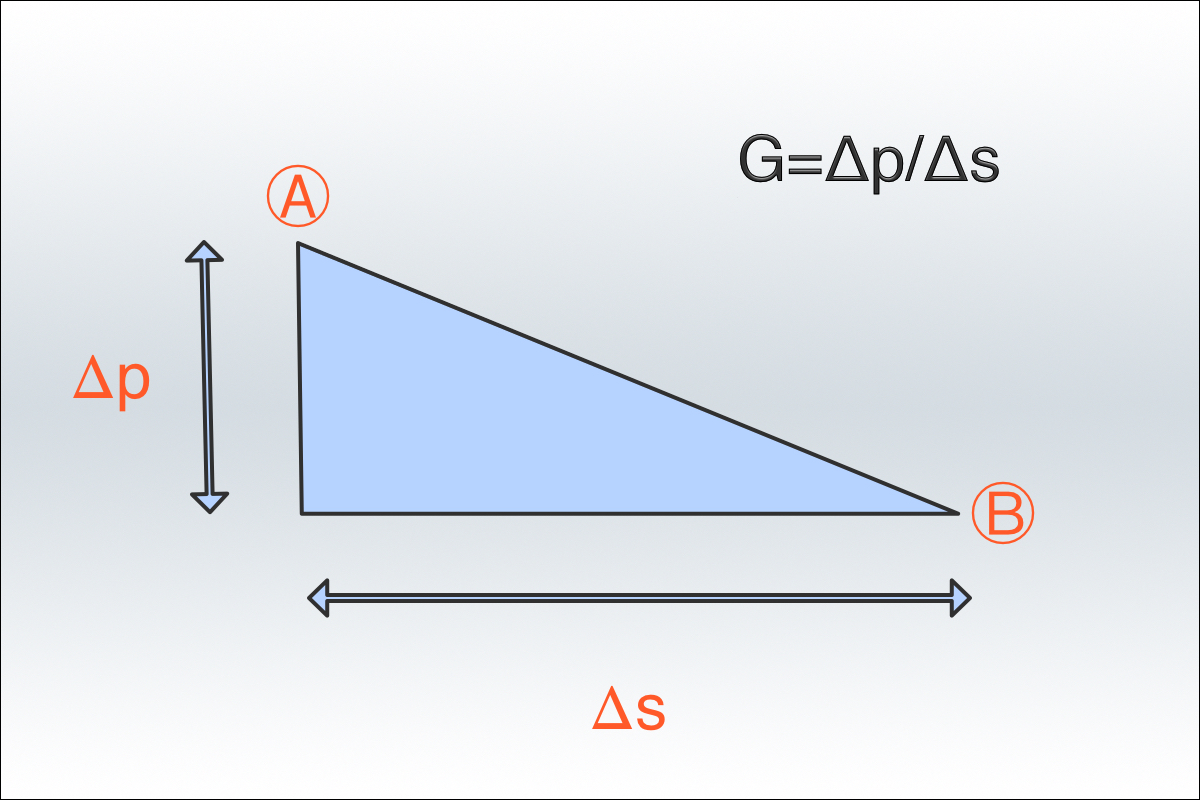
The higher the pressure difference, the stronger the force exerted is.
Synoptic charts provide helpful information on wind speed through the Pressure Gradient, which indicates the pressure difference relationship between two isobars and their distance.
The narrower the isobars, the higher the G ratio and the stronger the wind. Therefore, we will have a high-pressure gradient value in the cyclonic areas and a low one in the anticyclones.
The earth’s rotation affects the intensity and direction of the wind. The moving air does not move linearly but proceeds in a spiral, undergoing the ‘Coriolis Force’ effect. The earth’s rotation generates this, and this force determines the course of the air masses; to the right (clockwise) in the northern hemisphere and the left (counterclockwise) in the southern one.
The earth’s surface affects the intensity of the wind. The friction between the Earth and the moving air mitigates its force on the ground. If, for example, at sea level, we have a wind of 5 knots, at 2 meters high, its speed could be 11 knots, at 15 meters, it could be 20 knots and so on. When we talk about measuring the wind speed on the ground, we conventionally mean that taken at 10 meters high.
Wind helps us identify where depression is. Buys-Ballot’s law tells us that (in our hemisphere/Northern hemisphere), if we turn our backs to the wind, we will find the Anti-cyclone on our right and the low-pressure area on our left.
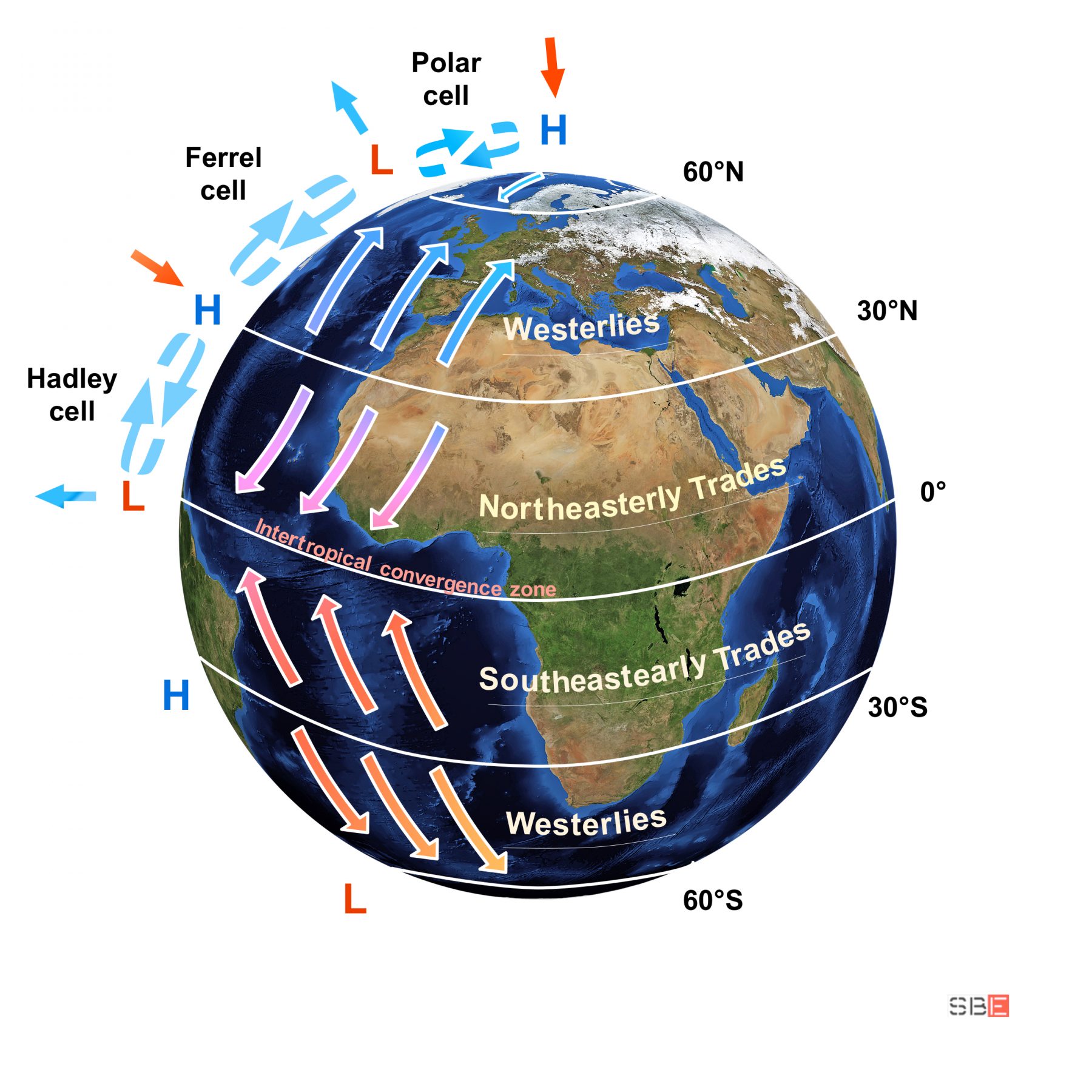
The trade winds are stationary and constant winds that, with an average speed of about 10-12 knots, remain throughout the year on the Atlantic Ocean, extending to 30 ° South and North of the equator blowing in the same direction. They are winds generated by upward motions near the equator and downward movements in subtropical areas. This circulation of air masses creates jet streams at high altitudes, and air flows return to the surface, deflected by the Coriolis force, forming tropical cells (Hadley cells). The area where the trade winds converge is called the intertropical convergence zone and roughly corresponds to the geographic equator, in a latitude variation between 3 ° South and 10 ° North according to the seasons. In the equatorial zone, the trade winds are channelled towards higher altitudes, creating an area with no wind and a calm sea (The intertropical convergence zone – doldrums).
The other constant winds of mid-latitudes, between 30 ° and 60°, are generated by the subtropical high-pressure bands and the permanent low-pressure bands (Ferrel cell) and move in the opposite direction to the trade winds. While beyond 60 ° in the polar cell that extends from the ‘subpolar low-pressure band’ to the ‘high-pressure polar band’, polar winds are created that return to head towards the trade winds. We can summarise this complex air circulation in the following image: