Surface Drift and Local Currents; Coriolis/Ekman
Surface currents most interest us for the practical purposes of naval manoeuvring or navigation; the wind is their main engine. They are limited to the ocean’s upper layer, estimated at 100 meters.
The constant solid winds, the trade winds that blow over the Atlantic and Pacific Oceans, move vast water masses westward, creating continuous drift currents.
These currents are contrasted in tropical latitudes (30 ° N – 30 ° S) and polar ones (60 ° N – 60 ° S) by strong variable winds directed to the East, which, together with the Coriolis force, create a circular circulation (gyres) clockwise in the Northern hemisphere and counterclockwise in the Southern hemisphere.
The gyres are large vortices in which winds and currents move. Local terrestrial or seasonal winds such as monsoons can influence them so much that they can reverse their motion in particular seasons.
The general circulation of surface currents – that is, the tendency of the movements of water masses over a long period – is collected in the World Climatic Charts.
More information can be found in the ADMIRALTY Ocean Passages for the World (NP136), particularly in the ADMIRALTY Sailing Directions (Pilots). These publications are where we see all the data regarding the dangers to navigation, reports and local regulations, etc., and climatic conditions and seasonal coastal currents.
The intensity of the current can reach the value of 1.5% of the wind speed that generated it. It depends on the duration of the wind over time (at least 48 hours in case of strong winds & 6 hours for light winds) and the width of the fetch (the width of the stretch of water free from obstacles).
Once the wind sets the ocean surface in motion in a current, the Coriolis force, Ekman transport and the ocean basin configuration change its speed and direction.
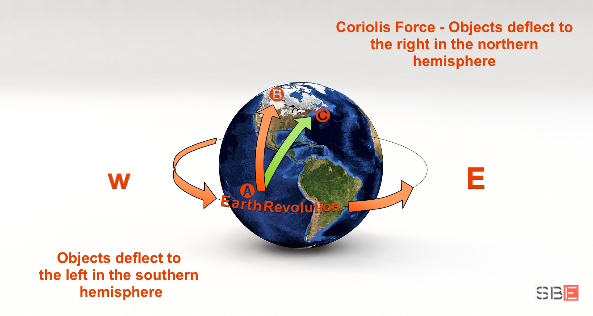
Due to the earth’s rotation, the Coriolis force causes the deviation of the surface layer of water pushed by the wind. The variation depends on the linear speed, which (unlike the angular one) varies with latitude. It is to the right in the Northern hemisphere and left in the Southern hemisphere. In theory, the Coriolis force deflects the current at about 45 ° regarding the wind direction.
Ekman transport indicates the change in direction and speed of the water motion at different depths. The spiral that describes this effect tells us that each deeper layer moves – depending on the hemisphere considered – to the right or left of the previous one and at a lowering speed.
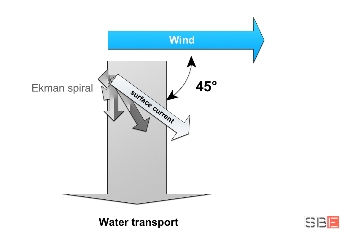
These two factors (Coriolis effect and Ekman transport) theorise that the surface current is deflected from 45 to 90 degrees concerning the wind direction, to the right in the Northern hemisphere and to the left in the Southern hemisphere.
However, in reality, several factors affect these forces, making it difficult to accurately predict the direction of the current relative to the wind. For example, the Ekman spiral may not fully develop in shallow waters, and the resulting angle may be significantly smaller than the open sea.
Unlike drift, the local variable surface currents depend on wind intensity, precipitation, heating and cooling.
In the vicinity of the coast, ascending or descending currents can form an Upwelling or Downwelling stream due to the Ekman effect. In Upwelling, the resulting current runs towards the shore by immersing itself, while in Downwelling, it runs from the land towards the open sea. Or, if the onshore wind blows with adequate intensity, the water can be forced along the coast, generating a sideshore stream, a robust local current that runs parallel to it.
We must rely on empirical methods or visual observations to assess the ‘local current’ impact on navigation. We will talk about it later.